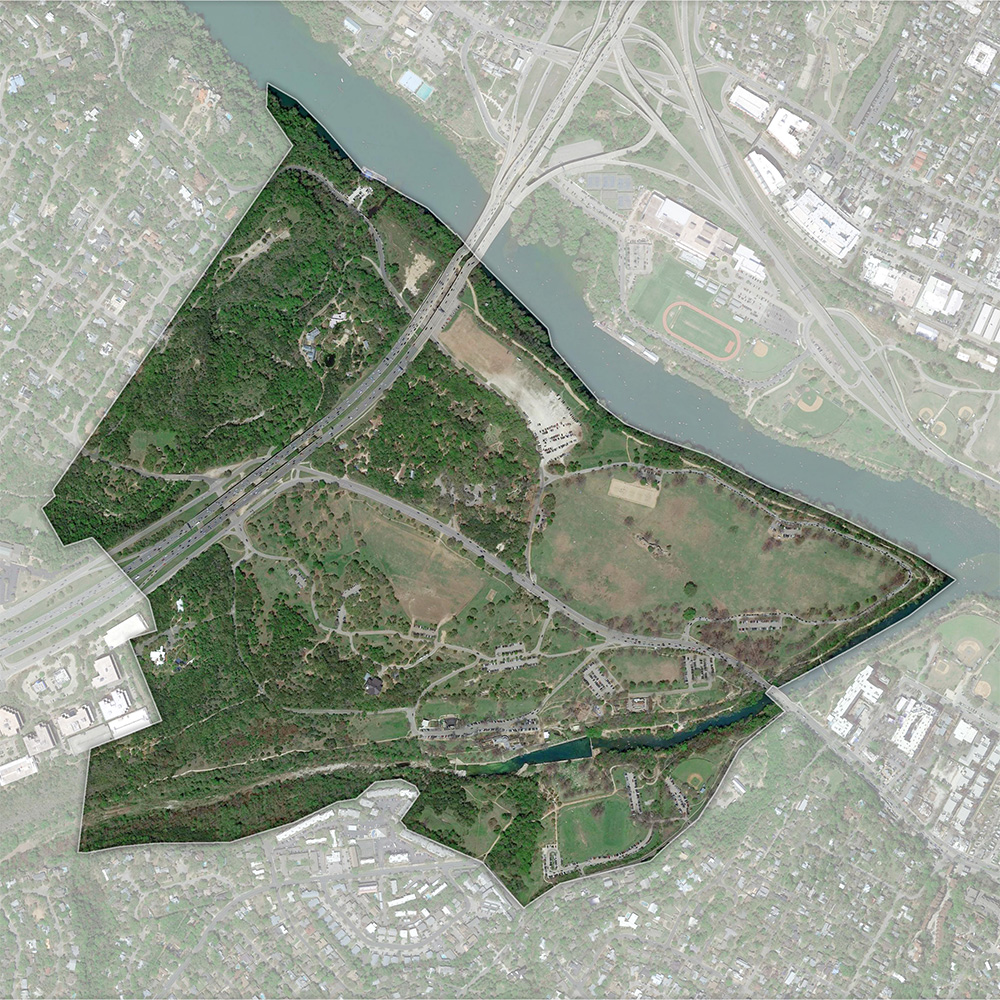
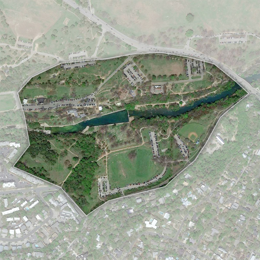
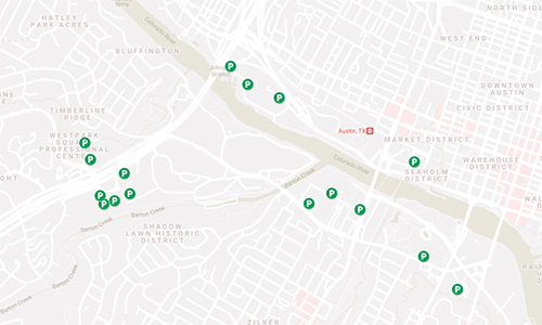
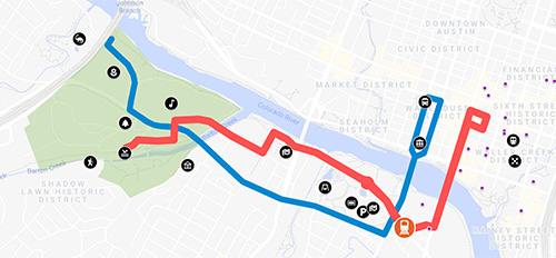
Welcome to Zilker Metropolitan Park Vision Plan Interactive Map!
We invite you to review the design alternatives that can be found throughout the Park. The Park is divided into seven zones, which are Polo Field, Zilker Nature Preserve, The Trailhead, Barton Springs Pool, The Great Lawn, MOPAC, and The Zilker Botanical Garden. Click on an area of interest and then zoom in to the proposed design alternatives for each area by clicking a dot on the map. Each dot represents different ideas, and it is color-coded based on different categories – Mobility/Accessibility/Transportation (blue), Ecology/Nature (teal), History/Programming (gold). Community members are invited to share their feedback on the accompanying survey. Your feedback will help shape the future of Zilker.
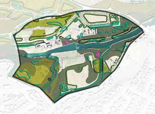
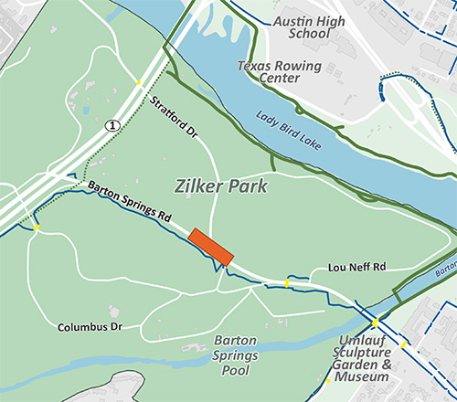
Zilker Park
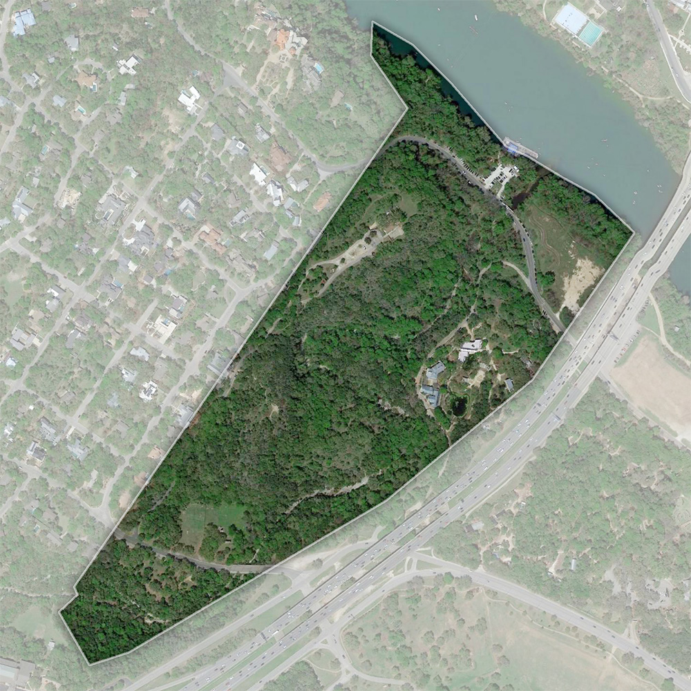
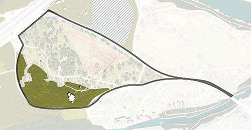
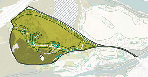
A: Nature Preserve Zone
B: MOPAC Zone
C: Zilker Botanical Garden Zone
D: Great Lawn Zone
E: Polo Field Zone
F: Barton Springs Zone
G: Trailhead Zone
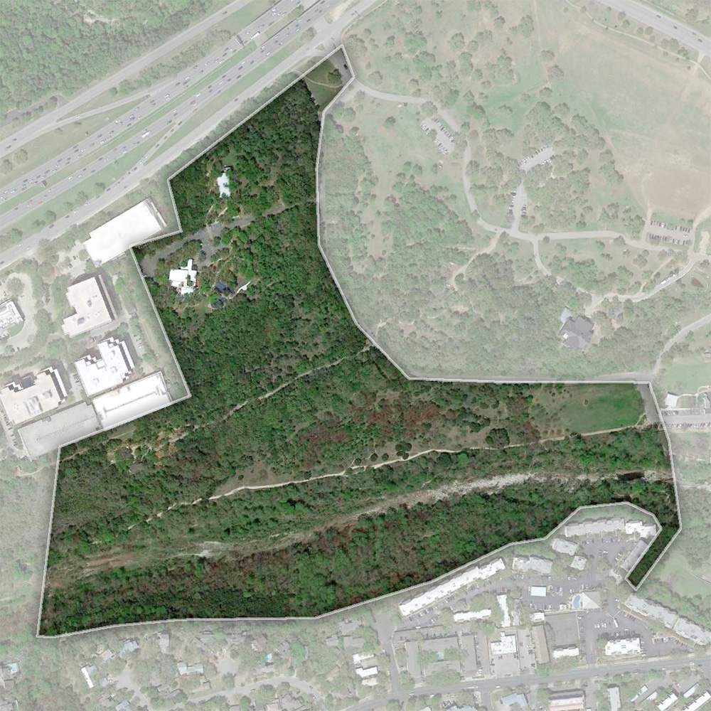
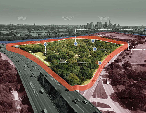
Nature Preserve Zone
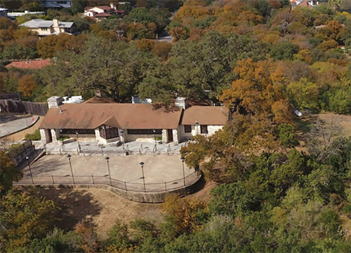
1: Zilker Clubhouse
2: Connect to Water
3: Stratford Drive
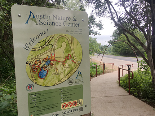
4: Austin Nature & Science Center
5: New Entrance to ANSC
6: Ecological Uplift
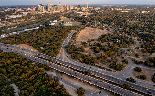
MOPAC Zone
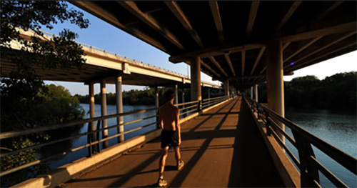
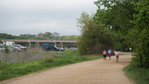
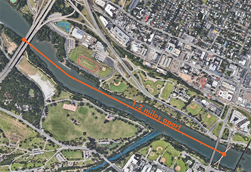
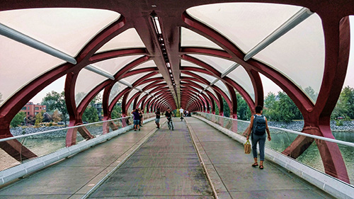
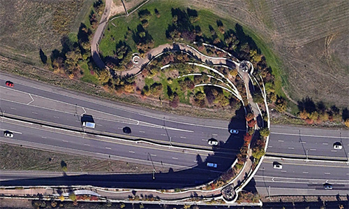
1: Improve Crenshaw Bridge
2: Improve Trail Connection
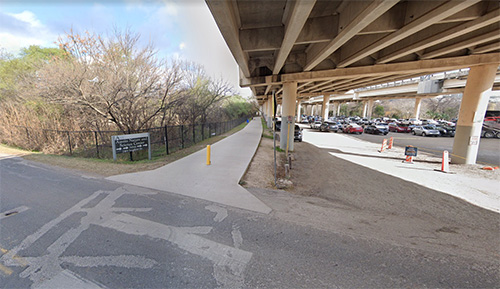
3: Parking Garage Under MOPAC
4: MOPAC South Environmental Study
5: New Entrance to ANSC
6: Activate Underused Spaces
7: Gateway
8: Ecological Uplift
The Trailhead Zone
1: Zilker West Gateway
2: Barton Creek Ecological Strategy
3: Exploring Enhancements to Girl Scout Cabin
Barton Springs Pool Zone
1: Potential Visitor Hub Location
2: Considering the Caretaker's Cottage
3: Barton Springs Pool Vision Plan
4: Barton Springs South Gateway
5: Ecological Uplift
6: Improve Degraded Barton Creek Banks
7: Repurposing Quonset Hut
8: Parking Strategies
Zilker Botanical Garden Zone
1: Potential North Gateway
2: Connection to the Water and Trail
3: Reimagining the Landfill
4: Stratford Drive Improvement
5: Zilker Botanical Garden Vision Plan
6: Parking Strategies
7: Ecological Uplift
Great Lawn Zone
1: Improve Connections Across the Lake
2: Parking Strategies
3: Pedestrianize Lou Neff Road
4: Extension of Toomey Road
5: Potential Visitor Hub
6: Ecological Uplift
Polo Field Zone
1: Exploring Barton Springs Road
2: Crossing Improvements
3: Barton Springs Road Bridge
4: Travel with Limited Mobility
5: Polo Field Enhancement
6: Main Gateway
7: Parking Strategies
8: Ecological Uplift
Mobility/Access
History/Programming
Ecology/Nature
Gateway
Separate Planning Effort
A
B
C
D
E
F
G
1
2
3
4
5
6
Zilker Clubhouse
Zilker Clubhouse Vision Plan (ongoing)
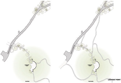
The Zilker Park Clubhouse (historically known as the Boy Scout Lodge) and the Lookout Point were both constructed in 1934. The purpose of the Clubhouse Rehabilitation was to focus on preserving the building’s character, while also improving flexibility within the site to host a variety of groups and events. The final plan also included improvements to the connectivity between the main hall and cottage, wayfinding and interpretive signage, and includes future phases that will improve the historic character of Lookout Point. Construction will begin in 2022.
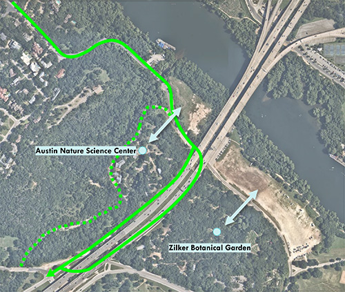
Connect to the Water
Connection to Lady Bird Lake is currently blocked by a fenced off area and land that was previously a landfill. The Austin Nature and Science Center has programming that could benefit from unimpeded access to the water, as well as the Austin community. The landfill adjacent to the Lake should be cleaned up and restored to improve water quality.
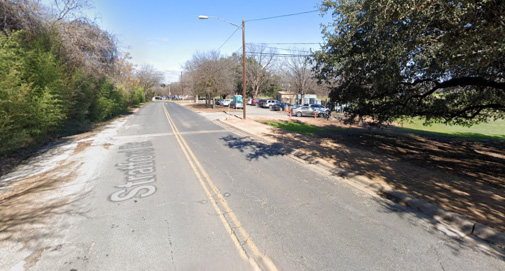
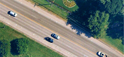
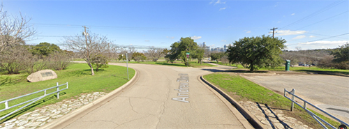
Stratford Drive
Make Stratford Bike and Pedestrian Only
Stratford Drive currently carries a small volume of traffic, but is dangerous for pedestrians and bicyclists since there are no connecting sidewalks. Stratford Drive could be realigned on either side of MoPac or along Nature Center Drive, opening up access for the Nature and Science Center and the Botanical Gardens to the Lake. By limiting access to bike and pedestrian use, we can create a direct nature transect from rowing boat to lookout point and change the main entrance for Austin Nature and Science Center to Nature Center Drive.
Austin Nature & Science Center
A separate planning process is underway for the Austin Nature and Science Center.
New Entrance to Austin Nature & Science Center
The main access point to Austin Nature and Science Center is off Stratford Drive currently. For those arriving by car or bus, the entry is not easily found and can be dangerous to cross Stratford Drive from the parking area under/adjacent to MoPac. Bus travel and drop-off is extremely challenging due to orientation of the entry and how buses typically arrive to the ANSC. By realigning Stratford Drive, pedestrians can more safely enter the ANSC from the north.
Ecological Upflift
More Mowed Park: In this scenario areas currently seasonally mowed or used as temporary parking are planted with turf grass and maintained regularly as turf. Active management occurs mostly in mowed areas.
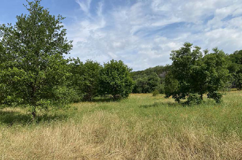
Ecological Uplift: More shade and stormwater management are used to create a better user experience and increase ecological function in active park areas. Unused mowed areas are ecologically restored. Woodlands, savannas, and meadows are managed to increase their health. This scenario creates more chances to enjoy nature, increases biodiversity, reduces stormwater impacts, and addresses climate change.
Ecological Uplift Plus: This scenario builds on the Ecological Uplift scenario with expansion of ecological restoration into some active park areas that can be accommodated in other parts of the park or other parks.
1
2
3
4
5
6
7
8
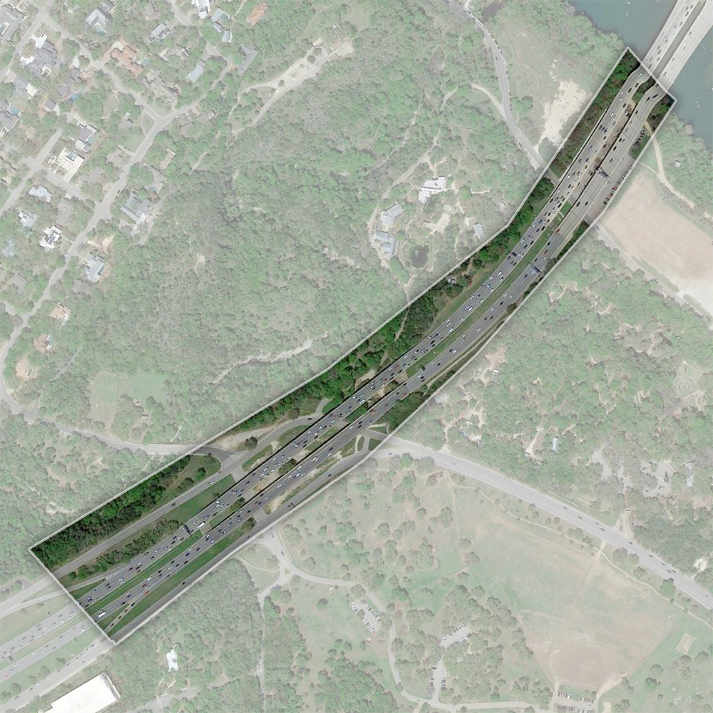
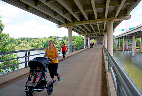
Improve Crenshaw Bridge
Improvements to the MoPac Roberta Crenshaw Pedestrian Bridge might include signage for better wayfinding, lighting, emergency buttons, and designated lanes for bikes and pedestrians. The improvements could also include adding an additional bridge structure to serve as a transit connection for shuttles or circulators.
Improve Trail Visibility
Improve visibility and access points to and from the Butler Trail, as well as improve access to the Roberta Crenshaw Pedestrian Bridge.
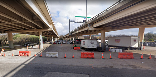
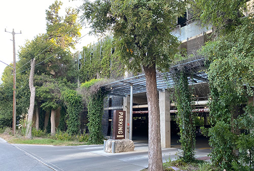
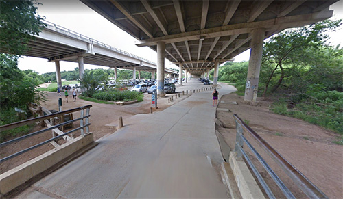
Parking Garage under MOPAC
The primary purpose of the road network throughout Zilker Park is to connect the disparate parking lots spread throughout the park. By consolidating parking into one central location, more open green space and less impervious cover could be gained. If a garage were to be located in this area, the north side of the park could become a main gateway into the park.
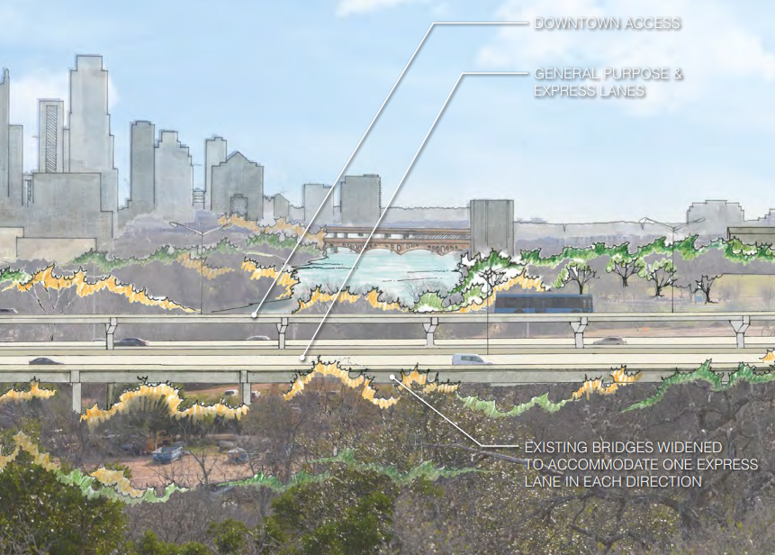
MOPAC South Environmental Study
The Environmental Study for the MoPac South area has been underway since 2013. The purpose of the study is to alleviate growing congestion through recommendation of an Express Lane, that would carry transit into and away from downtown. More detailed information can be found the website http://www.mopacsouth.com/.
New Entrance to Austin Nature and Science Center
The main access point to Austin Nature and Science Center is on Stratford Drive currently. The current north entrance is challenging to navigate and if Stratford Drive is realigned, thus removing the north entrance, this southern entrance could become the primary entry to the ANSC.
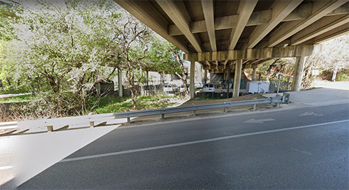
Activating Underused Spaces
Currently, the space under MoPac near Barton Springs Road in the south part of Zilker Park is mostly empty or used for maintenance vehicle parking. By activating the space with park programming, parking, maintenance needs, lighting, or other elements, it can make leftover space useful and safe. Precedents of under-freeway development include theater space, skate park, outdoor fitness area, parking and maintenance facilities.
Ecological Uplift
The lack of ecological presence in this area is due to the construction of MoPac. Ecological recommendations include removal of invasive species and replanting with native plants.
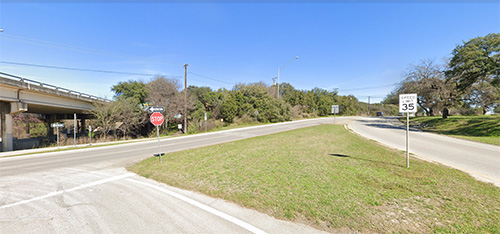
Gateway
This location could be a main gateway for visitors from the MoPac feeder or Rollingwood Drive. The speed is signed at 35 mph but cars often travel much faster. The absence of a clear gateway contributes to the safety concerns in this area.
1
2
3
4
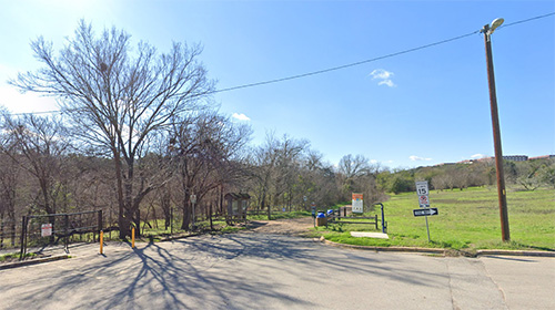
Zilker West Gateway
Currently, there is not a formal entry to Zilker Park on the west side of the park near the Barton Oaks Plaza development. Adding another point of entry could alleviate congestion at the entry points on Barton Springs Road. There is also potential to collaborate with nearby businesses in this area to offer parking for Zilker Park users during limited hours in the existing parking garages.
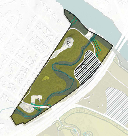
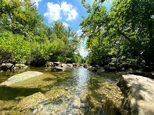
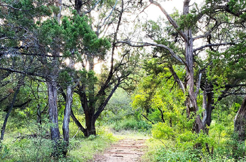
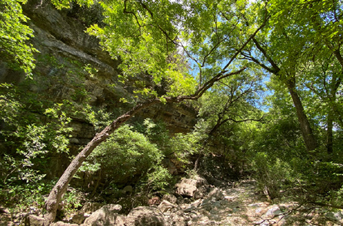
Barton Creek Ecological Strategy
The upper Barton Creek is home to the Barton Springs Salamander, as well as approximately 2,600 linear feet of Barton Creek. Ecological management recommendations include woodland enhancement, riparian woodland expansion, and meadow enhancement.
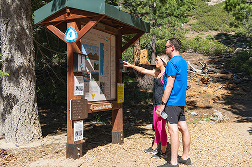
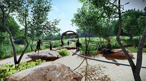
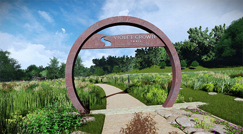
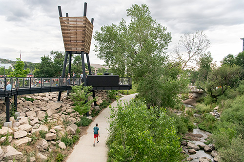
Violet Crown Trailhead Vision Plan
The Violet Crown Trail planning process began in 2006. The purpose was to create Central Texas’ first regional train system. The trail is now 13 miles long starting at Zilker Park to Lady Bird Johnson Wildflower Center. Once the project is complete, it will be the longest trail in Central Texas reaching to about 30 miles long.
Source: Violet Crown Trailhead Vision Plan, TBG.
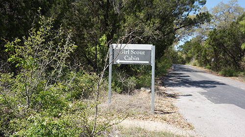
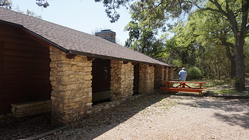
Exploring Enhancements to Girl Scout Cabin
This concept enhances the existing historic Girl Scout Cabin to make the building and the site more conducive to a greater breadth of programming opportunities. Perched on a bluff above Barton Creek, it is well-positioned as a place of nature education. This concept involves rehabilitating the building itself, but more importantly it suggests the addition of outdoor enhancements for both education and for connectivity. Its remote location is both a challenge and an asset. Access can be improved through a sharing agreement with off-site parking facilities.
1
2
3
4
5
6
7
7
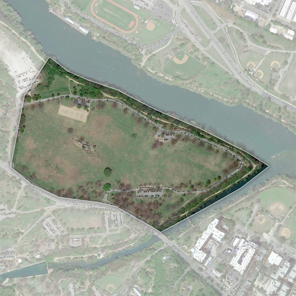
Potential Visitor Hub
This location is already the park’s major activity hub so by adding a visitor hub it can create synergy with existing programming for educational or recreational purposes. However, it can also be a congestion of programs and cause parking issues. And to avoid building on floodplain, it will be uphill from the pool and the creek, creating accessibility challenges.
The Caretaker’s Cottage is repurposed for welcome and classroom activities. It could also hold some office space. To complement this repurposing, the nearby Quonset Hut is used as an outdoor classroom. In this way, current educational activities that involve exploratory excursions to the creek followed by a classroom-setting review of findings is accommodated within a compact, convenient geography.
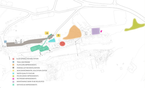
Considering the Caretaker's Cottage
This concept uses existing resources to offer public welcoming services and to support the mission of education—instead of building a new building complex. In this concept, the visitor center idea functions in lower-key terms that don’t endeavor to be a front-and-center face for the park. Instead, it focuses on existing historic resources—in particular, the Caretaker’s Cottage and the historic Quonset Hut (in the soon-to-be-moved maintenance yard) are identified, partially for their practicality (they are already there) and partially for their proximity to the pool, the creek and the spring activity. The concept is intended to complement ecological restoration recommendations in other parts of the Vision Plan.
The Caretaker’s Cottage is repurposed for welcome and classroom activities. It could also hold some office space. To complement this repurposing, the nearby Quonset Hut is used as an outdoor classroom. In this way, current educational activities that involve exploratory excursions to the creek followed by a classroom-setting review of findings is accommodated within a compact, convenient geography.
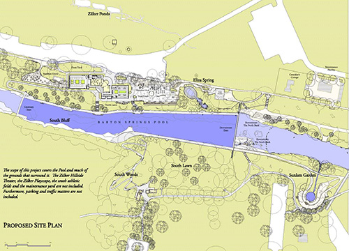
The Barton Springs Vision Plan began in 2006 to improve the water quality, salamander habitat, grounds, infrastructure, and facilities. After an extensive public engagement process, the final vision plan proposed cleaner water, while also improving the experience of the pool. It also proposed additions and renovations to the pool area, buildings, and grounds to ultimately represent the natural and historical environment. Barton Springs Pool and Bathhouse are not included in the Zilker Park Vision Plan process due to their own plans and processes already underway.
Barton Springs South Gateway
The area south of Barton Springs Pool already serves as a gateway to the park, although highly disorganized. A gateway would have better designed entry and parking sequence, with better connectivity to Azie Morton Drive, the Umlauf and Zilker Park trails. The lawn area can provide a similar experience to the Great Lawn in the north part of Zilker Park, but on a smaller scale.
Ecological Uplift
More Mowed Park: In this scenario areas currently seasonally mowed or used as temporary parking are planted with turf grass and maintained regularly as turf. Active management occurs mostly in mowed areas.
Ecological Uplift: More shade and stormwater management are used to create a better user experience and increase ecological function in active park areas. Unused mowed areas are ecologically restored. Woodlands, savannas, and meadows are managed to increase their health. This scenario creates more chances to enjoy nature, increases biodiversity, reduces stormwater impacts, and addresses climate change.
Ecological Uplift Plus: This scenario builds on the Ecological Uplift scenario with expansion of ecological restoration into some active park areas that can be accommodated in other parts of the park or other parks.
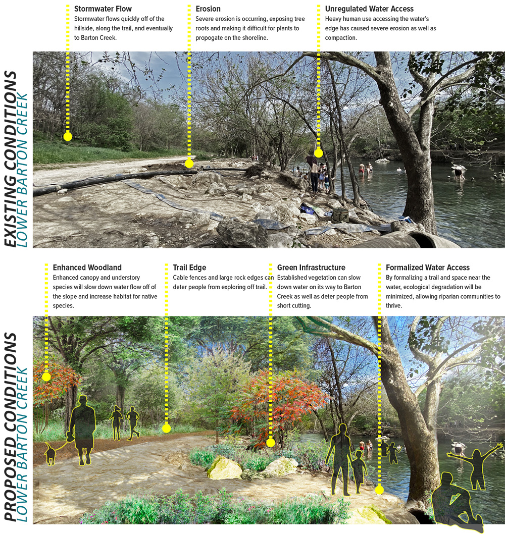
Improve Degraded Barton Creek Banks
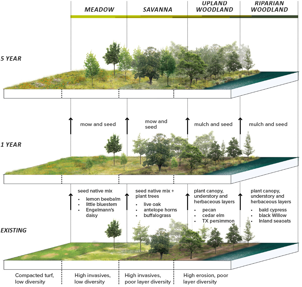
The graphic visualizes the Lower Barton Creek transformation. Green infrastructure works in collaborate with enhanced woodland and formalization of the trail edge and water access in order to create an exceptional space for humans and critters. Existing Condition shows degradation from lack of stormwater management upslope, trampling, and flooding that has resulted in compacted soils, erosion, an incomplete canopy, struggling vegetation, and a degraded user experience. Proposed condition shows the ecological health and enhanced user experience that results by addressing upslope stormwater with green stormwater infrastructure, formalizing trails and water access, installing physical barriers to plantings, decompacting soils, and planting robust native canopy, understory, and groundcover vegetation.
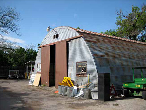
Repurposing Quonset Hut
This concept uses existing resources to offer public welcoming services and to support the mission of education—instead of building a new building complex. In this concept, the visitor center idea functions in lower-key terms that don’t endeavor to be a front-and-center face for the park. Instead, it focuses on existing historic resources—in particular, the Caretaker’s Cottage and the historic Quonset Hut (in the soon-to-be-moved maintenance yard) are identified, partially for their practicality (they are already there) and partially for their proximity to the pool, the creek and the spring activity. The concept is intended to complement ecological restoration recommendations in other parts of the Vision Plan.
The Caretaker’s Cottage could be repurposed for welcome and classroom activities. It could also hold some office space. To complement this repurposing, the nearby Quonset Hut is used as an outdoor classroom. In this way, current educational activities that involve exploratory excursions to the creek followed by a classroom-setting review of findings is accommodated within a compact, convenient geography.
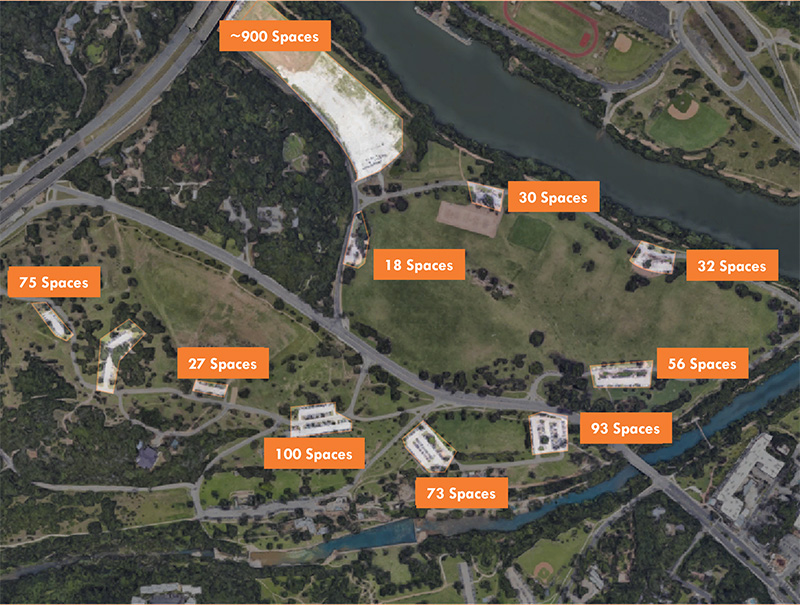
Parking Strategies
Consolidate Parking
Parking lots in Zilker are currently atomized, spread around the park. The primary purpose of much of the road network is to reach small parking lots spread throughout the park. Consolidating facilities would open up more green space by reducing the vehicle circulation footprint and creating more of a “park once” consolidated parking area(s).
Shared Parking
This concept reduces ecological impact of parking surfaces by making more efficient use of parking spaces at more times of the day rather than building separate facilities.
1
2
3
4
5
6
7
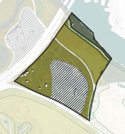
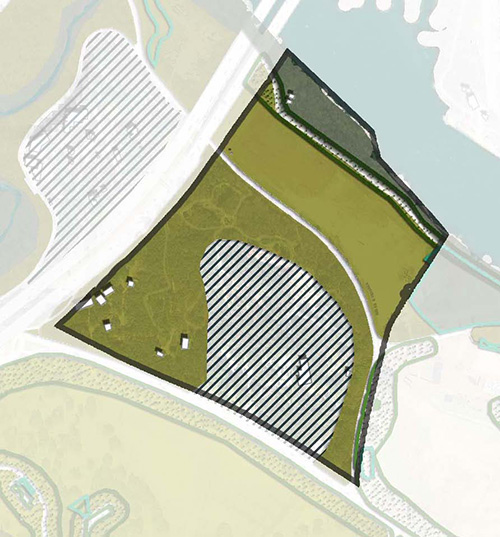
Zilker North Gateway
The north side of Zilker Park could serve as a gateway with improvements to the Crenshaw Bridge under MoPac, addition of a parking garage, and connection to Butler Trail and Zilker Botanical Garden, restoring an environmentally degraded area to a valuable part of the park.
Connection to the Water and Trail
Access to Lady Bird Lake from this area can be challenging, although the landfill is currently how many park users access the park and Butler Trail. If Stratford Drive were to be realigned, and the landfill ecologically restored, the Botanical Gardens would then have a physical connection to the Lake within this area.
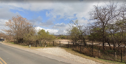
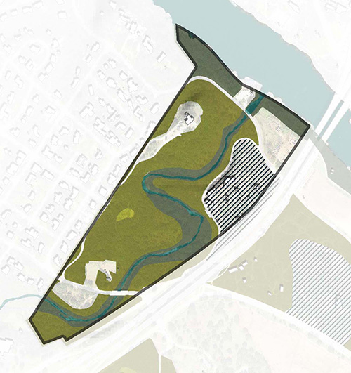
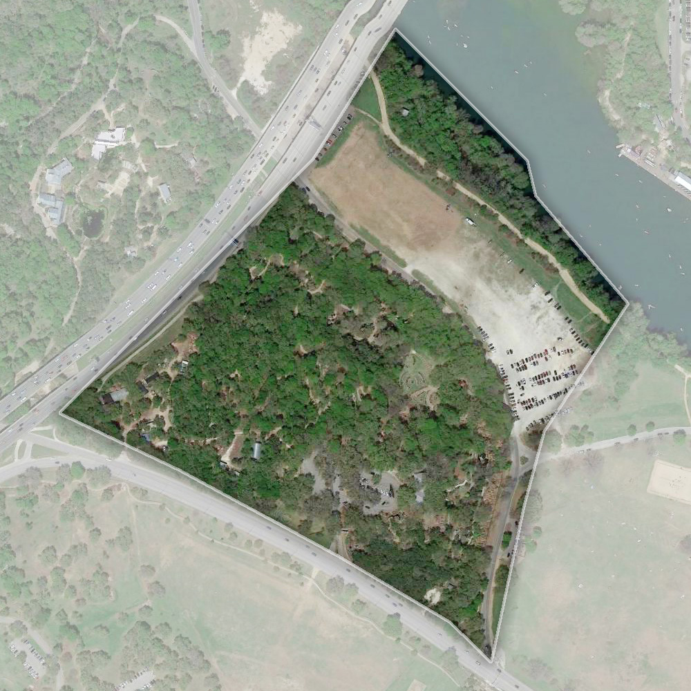
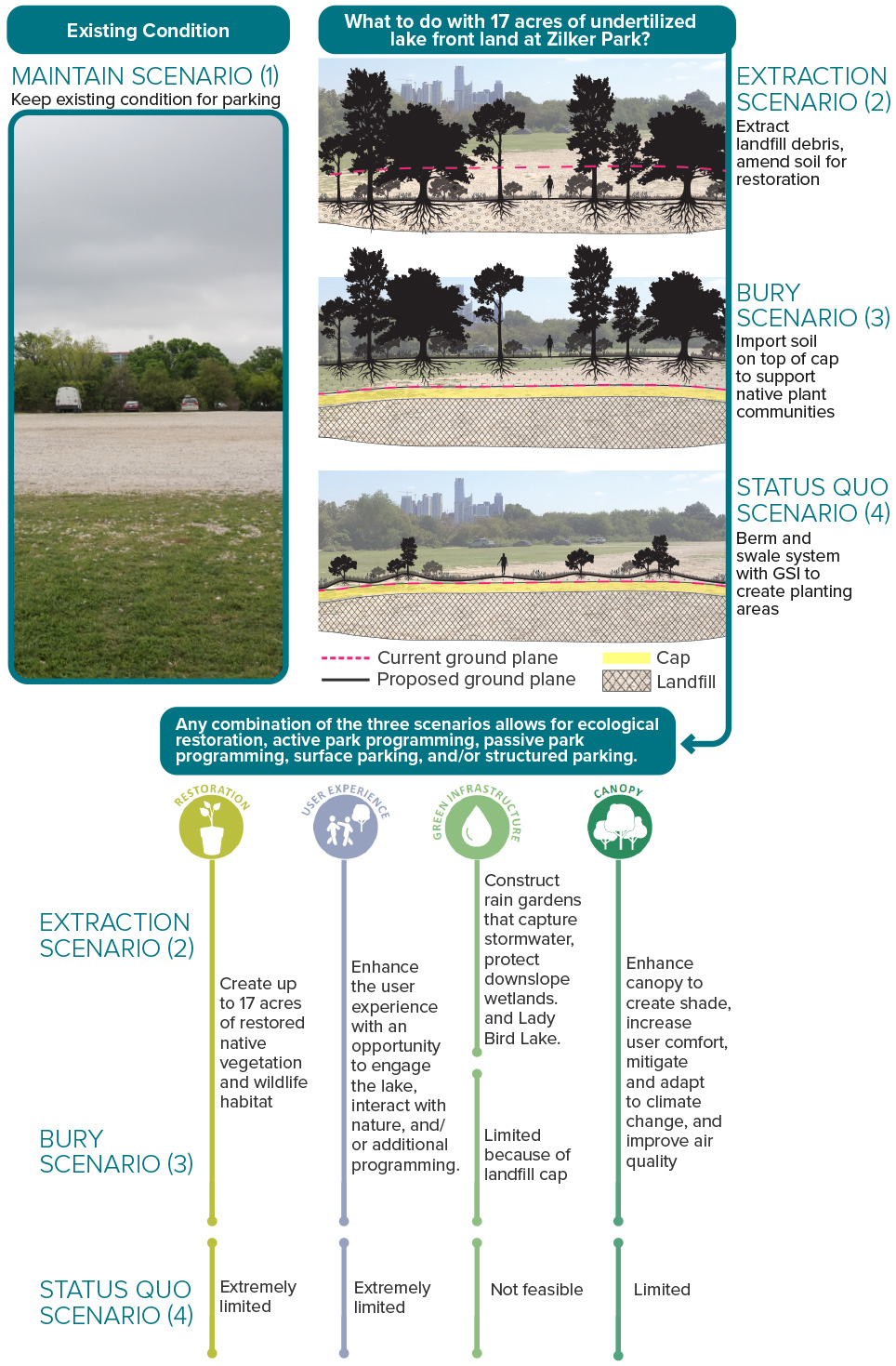
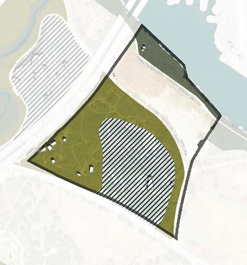
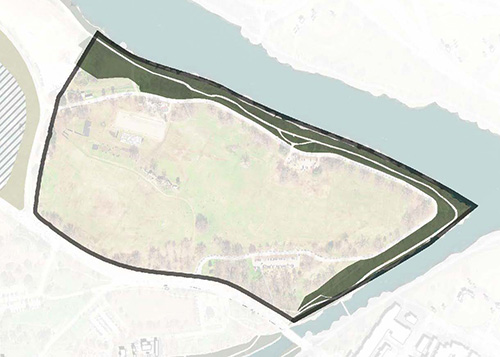
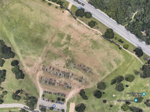
Reimagining the Landfill
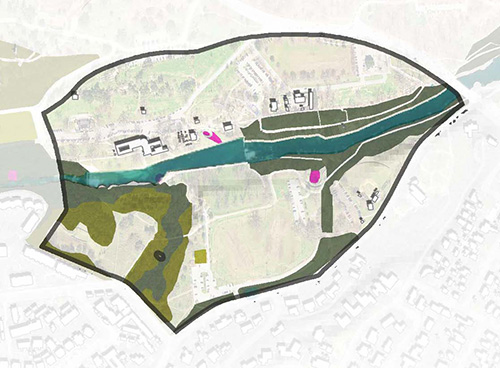
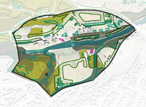
The landfill area is the most highly modified area in the park. This area is approximately 12 acres in total and has experienced deterioration over the past decade. This deterioration has created erosion, depressions in the landfill cap, undesirable vegetation growth, and drainage issues.
The 17 acres adjacent to the Ann and Roy Butler Hike and Bike Trail and adjacent to Lady Bird Lake are currently being used as a gravel part-time, parking area. The space is also an old landfill that may need mitigation and improvements. Thinking about the Zilker Park Vision Plan as a long-term plan, what would be the best outcome for 17 acres at Zilker park next to the lake?
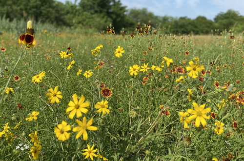
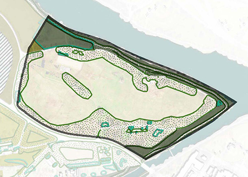
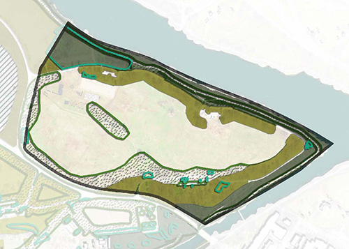
Upland Woodland
Riparian Woodland
Savanna
Meadow
Below are three scenarios of what could happen besides leaving it like it is.
Excavate the entire landfill. This would be complicated and expensive and take further study.
Maintain the cap to state standards and add soil so that additional plans or programs could be possible.
Minor improvements, which would limit future options.
Each of these scenarios could be mixed and matched and offer opportunities for ecological uplift, active park programming, passive park programming, surface parking, and even structure parking.
Stratford Drive currently carries a small volume of traffic, but is dangerous for pedestrians and bicyclists since there are no connecting sidewalks. Stratford Drive could be realigned on either side of MoPac or along Nature Center Drive, opening up access for the Nature and Science Center and the Botanical Gardens to the Lake. By limiting access to bike and pedestrian use, we can create a direct nature transect from rowing boat to lookout point and change the main entrance for Austin Nature and Science Center to Nature Center Drive.
Zilker Botanical Garden Vision Plan
The Zilker Botanical Garden’s (ZBG) Phase I master plan focused on the current and future opportunities that ZBG offers locally, regionally, and nationally, while keeping in mind the nationally recognized events: the Trail of Lights and Austin City Limits Music Festival. The Phase 2 of the ZBG Vision Plan will commence in 2022 and will focus on recommendations to the ZBG building from recommendations from the Zilker Park Vision Plan proposed improvements to the existing program, environment, and infrastructure, while also focusing on the relationship to its surrounding context, proximity to near by destinations, and increasing future use of Zilker Park locally and nationally.
Source: Zilker Botanical Garden Vision Plan.
Parking Strategies
Consolidate Parking
Parking lots in Zilker are currently atomized, spread around the park. The primary purpose of much of the road network is to reach small parking lots spread throughout the park. Consolidating facilities would open up more green space by reducing the vehicle circulation footprint and creating more of a “park once” consolidated parking area(s).
Shared Parking
This concept reduces ecological impact of parking surfaces by making more efficient use of parking spaces at more times of the day rather than building separate facilities.
Ecological Uplift
More Mowed Park: In this scenario areas currently seasonally mowed or used as temporary parking are planted with turf grass and maintained regularly as turf. Active management occurs mostly in mowed areas.
Ecological Uplift: More shade and stormwater management are used to create a better user experience and increase ecological function in active park areas. Unused mowed areas are ecologically restored. Woodlands, savannas, and meadows are managed to increase their health. This scenario creates more chances to enjoy nature, increases biodiversity, reduces stormwater impacts, and addresses climate change.
Ecological Uplift Plus: This scenario builds on the Ecological Uplift scenario with expansion of ecological restoration into some active park areas that can be accommodated in other parts of the park or other parks.
1
2
3
4
5
6
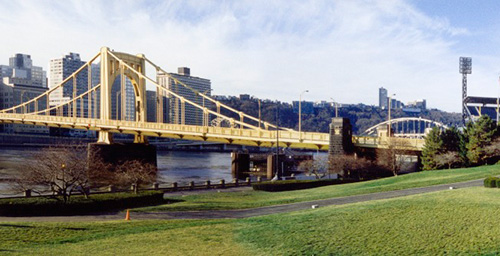
Improve Connections Across the Lake
While not without a significant price tag, additional infrastructure connections between the park and downtown could be considered. In choosing any transit approach, it’s important to start with the functional goal in mind and work backward to appropriate mode.
Parking Strategies
Consolidate Parking
Parking lots in Zilker are currently atomized, spread around the park. The primary purpose of much of the road network is to reach small parking lots spread throughout the park. Consolidating facilities would open up more green space by reducing the vehicle circulation footprint and creating more of a “park once” consolidated parking area(s).
Shared Parking
This concept reduces ecological impact of parking surfaces by making more efficient use of parking spaces at more times of the day rather than building separate facilities.
Pedestrianize Lou Neff Road
Lou Neff Road currently serves three small parking lots and continuous street parking. However, major egress conflicts make it challenging to navigate during peak hours. Removing Lou Neff Road would remove a barrier to Lady Bird Lake and Butler Trail, creating more green space. Alternative access scenarios for Trail of Lights and similar programs would be needed. Temporary closure to vehicular traffic - allowing bicycles and pedestrians only - could be a way to test-run the closure permanently.
Extension of Toomey Road
The nearest future light rail station will be at Auditorium Shores, servicing the future Orange and Gold Lines, bringing high capacity transit within 1.25 miles of Zilker – within range of first/last mile options.
A new circulator, bike and walk bridge near Toomey Road could create a route that helps the circulator avoid busy traffic, servicing access to and from and within the park.
Potential Visitor Hub
This location is outside of the Zilker Park boundary so that it can avoid the congestion with the park’s other activities with the potential new circulator it has a potential to be another gateway of the park.
Ecological Uplift
More Mowed Park: In this scenario areas currently seasonally mowed or used as temporary parking are planted with turf grass and maintained regularly as turf. Active management occurs mostly in mowed areas.
Ecological Uplift: More shade and stormwater management are used to create a better user experience and increase ecological function in active park areas. Unused mowed areas are ecologically restored. Woodlands, savannas, and meadows are managed to increase their health. This scenario creates more chances to enjoy nature, increases biodiversity, reduces stormwater impacts, and addresses climate change.
Ecological Uplift Plus: This scenario builds on the Ecological Uplift scenario with expansion of ecological restoration into some active park areas that can be accommodated in other parts of the park or other parks.
1
2
3
4
5
6
7
8
Exploring Barton Springs Road
Barton Springs Road
Barton Springs Road is a major connection to and from the core of Austin, but is a barrier dividing the park currently. With few crossings and high speed traffic, coupled with subpar non-auto trails, crossing by foot, bike, wheelchair, or scooter is an uncomfortable experience. Slowing down traffic speeds and creating safer crossings are essential.
Park Access Only
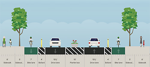
Barton Springs Road was not always a feeder to MoPac – it was originally designed and used to serve merely as a Zilker Park access road. Detaching the road from serving as a MoPac feeder would dramatically reduce traffic and volume and speed through the park, allowing more aggressive traffic calming and better crossings – knitting together the park while allowing transit circulation. It would, of course, remove a freeway access option. While major interventions like this are significant, it is important to keep in mind a long timeframe. After all, it was within the last century that personal vehicles became a major mobility force. Over a long time horizon, seismic shifts and design opportunities become tangible.
Traffic Calming
Additional calming features could include higher visibility or raised crosswalks, etc.
Temporary Intervention
Road closure and space reallocation could also be considered as temporary measures, in place during weekends only.
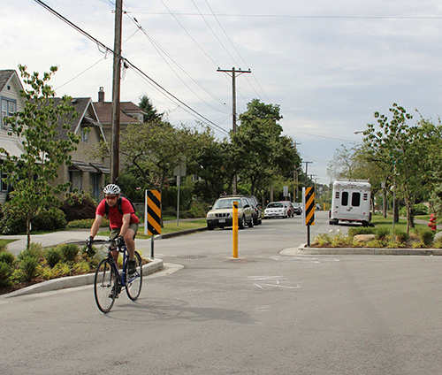
Crossing Improvements
Since Barton Springs Road is a main thoroughfare to the nearby neighborhoods, it bisects Zilker ultimately creating unsafe pedestrian, bike, and vehicular circulation. One option for Barton Springs Road is to improve crossings at multiple locations by implementing a pedestrian underpass or land bridge for easy and safe connections.
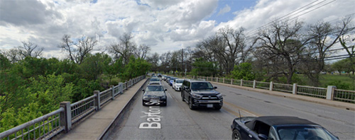
Barton Springs Road Bridge
Built in 1925, the Barton Springs Road Bridge Over Barton Creek requires rehabilitation or replacement
The bridge is in structurally fair condition, but further analysis is needed to address mobility issues for all users
In Nov. 2020, voters approved $25 million to continue to evaluate and address the Barton Springs Bridge
The next phase in the process completing the preliminary engineering phase, which includes developing a Bridge Conceptual Engineering Report (BCER)
Following the BCER, design considerations will be underway to select a bridge type and style (rehabilitation or new)
There will be multiple public input and engagement opportunities as this project completes the BCER and enters design phases
The first public meeting is being planned for late spring 2022
There is currently a planning effort underway to improve Barton Springs Road Bridge led by Austin Public Works Department.
Travel with Limited Mobility
Lacking sidewalks and accessibility features (beyond ADA parking spaces) between destinations, re-imagining the pathways within the park will improve accessibility. Circulator solutions must be ADA accessible.
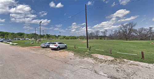
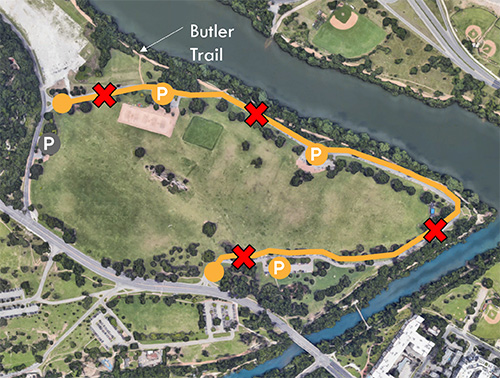
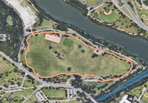
Polo Field Enhancement
Upland Woodland
Riparian Woodland
Savanna
Meadow
This area was not planned to be used for parking. In recent years, City Council has directed the Parks and Recreation Department to remove parking from the Polo Field area. Possible enhancements allow for maintained grass turf for active or passive recreation (similar to Great lawn) or ecological restoration to savanna or meadow. Currently this area is mowed seasonally.
Main Gateway
This area was not planned to be used for parking. In recent years, City Council has directed the Parks and Recreation Department to remove parking from the Polo Field area. Possible enhancements allow for maintained grass turf for active or passive recreation (similar to Great lawn) or ecological restoration to savanna or meadow. Currently this area is mowed seasonally.
Parking Strategies
Consolidate Parking
Parking lots in Zilker are currently atomized, spread around the park. The primary purpose of much of the road network is to reach small parking lots spread throughout the park. Consolidating facilities would open up more green space by reducing the vehicle circulation footprint and creating more of a “park once” consolidated parking area(s).
Shared Parking
This concept reduces ecological impact of parking surfaces by making more efficient use of parking spaces at more times of the day rather than building separate facilities.
Ecological Uplift
More Mowed Park: In this scenario areas currently seasonally mowed or used as temporary parking are planted with turf grass and maintained regularly as turf. Active management occurs mostly in mowed areas.
Ecological Uplift: More shade and stormwater management are used to create a better user experience and increase ecological function in active park areas. Unused mowed areas are ecologically restored. Woodlands, savannas, and meadows are managed to increase their health. This scenario creates more chances to enjoy nature, increases biodiversity, reduces stormwater impacts, and addresses climate change.
Ecological Uplift Plus: This scenario builds on the Ecological Uplift scenario with expansion of ecological restoration into some active park areas that can be accommodated in other parts of the park or other parks.